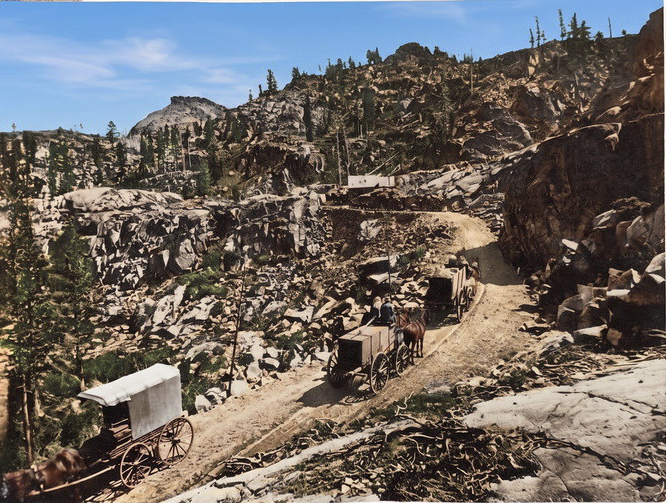
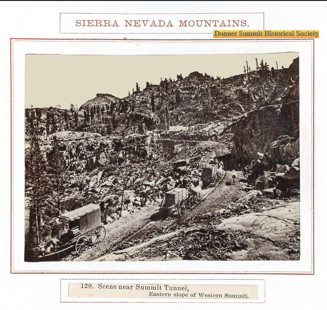
We’ve hiked up this road, and you can, too! What we’re looking at is a group of wagons filled with supplies headed up to the site of the famous Summit Tunnel of the transcontinental railroad at Donner Summit in 1867. The Dutch-Flat Donner Lake Wagon Road (DFDLWR) was built specifically to help with the railroad construction. This is a colorized version of a classic black-and-white photo by Alfred Hart, who was hired to document the railroad’s construction. I’ve posted the original black-and-white photo in the comments.
Sierra Nevada History
Maiden's Grave to Tragedy Spring on the 1848 California Trail
We decided to see if we could complete the hike we started a few weeks ago, from the Maiden's Grave to Tragedy Spring in Amador County, along the 1848 California Trail. We only got so far, as fire had wiped out many of the trail markers. We stopped last time on an eastward journey because we couldn't find the trail. This time we decided to head west from Tragedy Spring. We found the trail and completed the hike. We found some cool stuff along the way; I will relate it in another video. Coordinates: 38°38'22.64"N 120°08'48.66"W
The 1852 Johnson Cutoff Trail at Lake Tahoe by Cave Rock
The 1852 Johnson Cutoff Trail at Lake Tahoe by Cave Rock. There are still deep wagon swales visible. One of the clearest places left where you can walk in the exact tracks of the pioneers. The view over the lake makes the climb worth it. The trail comes back out on Highway 50.
Hope Valley, Alpine County: Pioneer Trail at Carson Creek
Monica and I headed out to beautiful Hope Valley, Alpine County, to see the California Pioneer Trail where it crosses Carson Creek.
1922 Moreland Truck at Johnson's Pass
Recently I was contacted by Greg Hull, who had worked for Cal Trans for thirty-three years as a construction engineer. His Father-in-Law was Darel Kehlet, whose family bought 640 acres on the west shore of Lake Tahoe and built Meeks Bay Resort from 1915-1969. Greg had inherited many family photos showing the resort's early development and surrounding highways and by-ways. He has kindly permitted these photos to be shared.

We see the Meeks Bay Resort Truck at the top of Johnson’s Pass at Echo Summit, looking east towards Lake Tahoe. The photo dates from 1922 or shortly after. It shows a man, woman, and dog, outside the truck, which has stopped at the pass. Johnson’s Pass was always a popular spot for travelers to snap photos. Just outside the frame, to the right, would be the Echo Summit Canteen Service Station owned by TC Wohlbruck, whom we discussed.
In the early days of automotive travel, trucks and cars would have to back up steep hills as these vehicles had not yet been equipped with fuel pumps. On its journey "down the hill" towards Placerville, this truck would include a drive backing up the nearby Slippery-Ford Grade on the Lincoln Highway. What an experience that must have been.
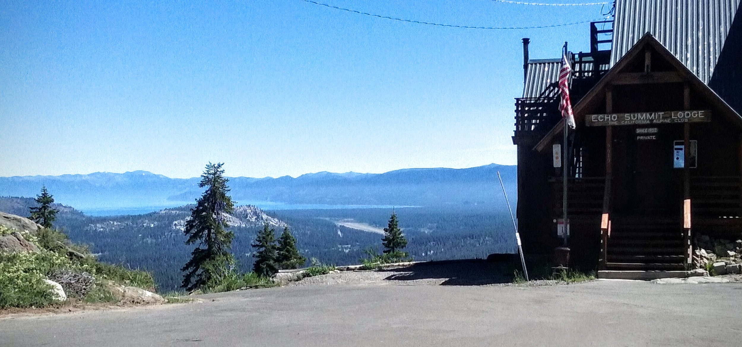
The same spot today!
Thanks to Greg Hull for sharing this and some other photos I hope to post here shortly. I have placed a comparison photo showing what the location looks like today
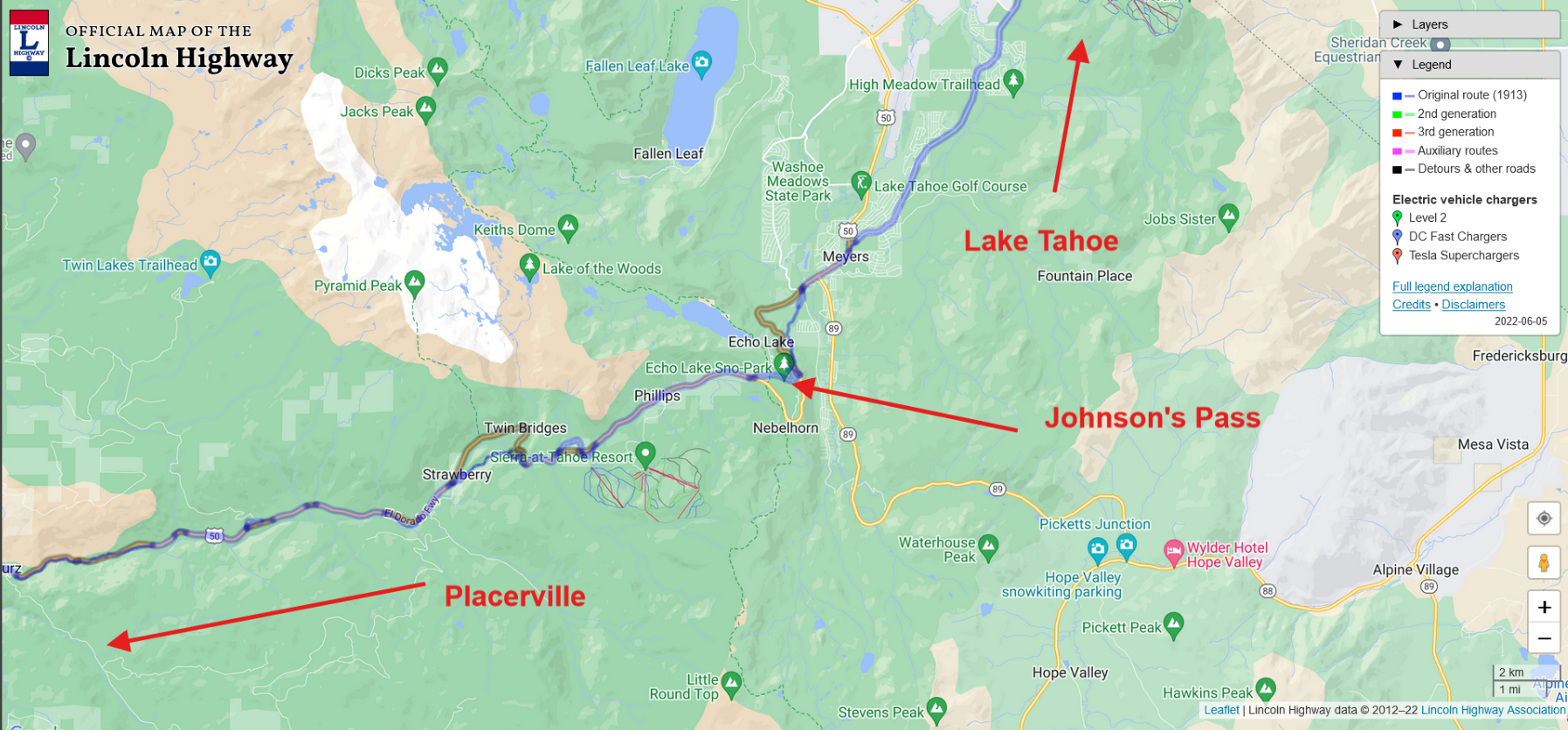
Location on map.
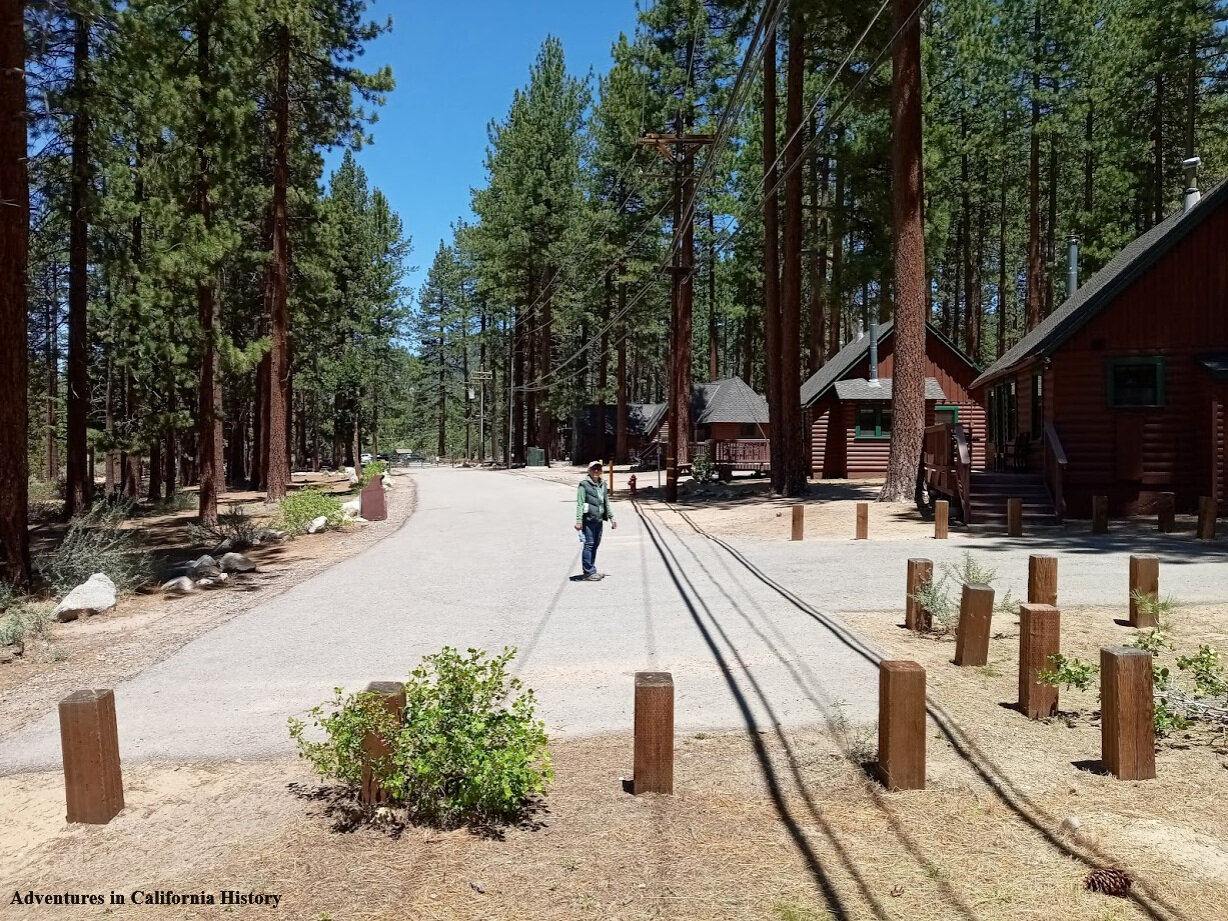
Following the Lincoln Highway at Zephyr Cove, Nevada
Monica is standing on the Lincoln Highway at the Zephyr Cove Lodge, Nevada. We had ventured over the state line following the Lincoln Highway up and over to Carson City. On the way, we stopped in Zephyr Cove to follow the highway's original course, which is behind the lodge on the current Highway 50. We are looking north in this photo.

Looking down the Lincoln Highway towards a fence that stops cars from entering the lodge area where Monica stood in the first photos. However, you can walk around the fence to access the lodge portion of the highway—some vintage cabins along the old road here.

The Old Lincoln Highway at Zephyr Cove is right along the water. It's just a hundred yards to the lake's edge. This strip of road has some great vintage cabins that once watched the transcontinental motorists pass by.

Turning around to face south, the old Lincoln Highway heads up the hill for about another 200 yards and eventually melds into the current Highway 50. Unfortunately, it’s a dead-end, and you’ll have to turn around and head back down the way you came.
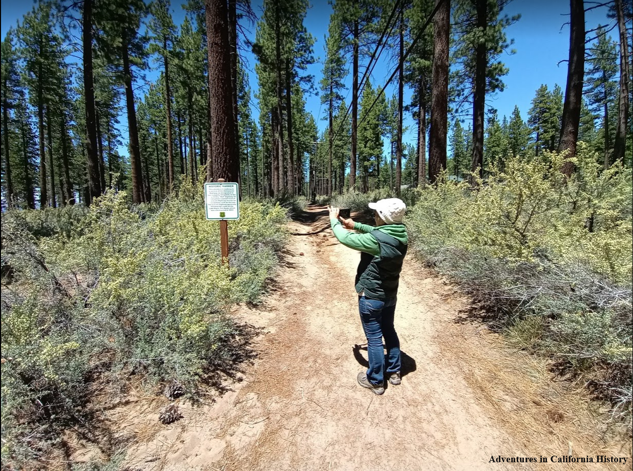
On the northern side of the Zephyr Cove Lodge parking lot is a dirt section of the old road. The Forest Service had placed a sign mentioning the importance of the old road. This section is some of the last original Lincoln Highway roadbeds around Lake Tahoe.

The Forest Service sign describing the Lincoln Highway around Lake Tahoe. Most of the road around Lake Tahoe was dirt back then. Imagine what an adventure it was for early motorists to travel around the lake on dirt wagon roads.

Map showing the general area around Zephyr Cove and the Lodge location.
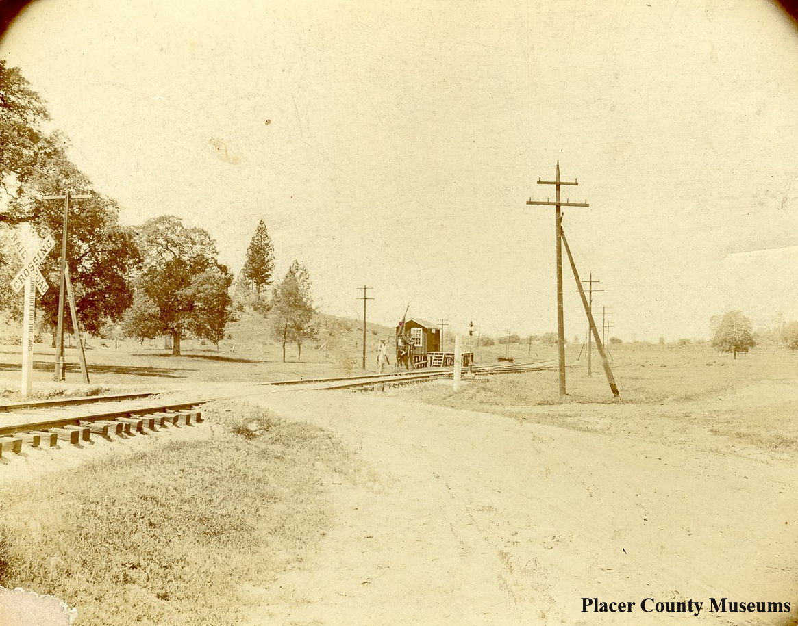
1900s photo of the Bowman crossing.
Bowman crossing and a newly found alignment of the Lincoln Highway.
The photo above, taken in the 1900s, shows the Bowman Crossing of the Southern Pacific Railroad. If you look closely, there is a person on a horse and another standing nearby. What caught my attention was the way the road makes a bend towards the photographer. If we head the other way, we will pass Machado’s Orchard on our way to Auburn once we cross the tracks. It was this photo that caused us to stop and check out this famous crossing again. We wanted to make sure our official Lincoln Highway map had the routes across the tracks marked correctly. We’ve checked out this area before but were unable to spot the old road. Recently someone has cleared out the area making it more open and visible.
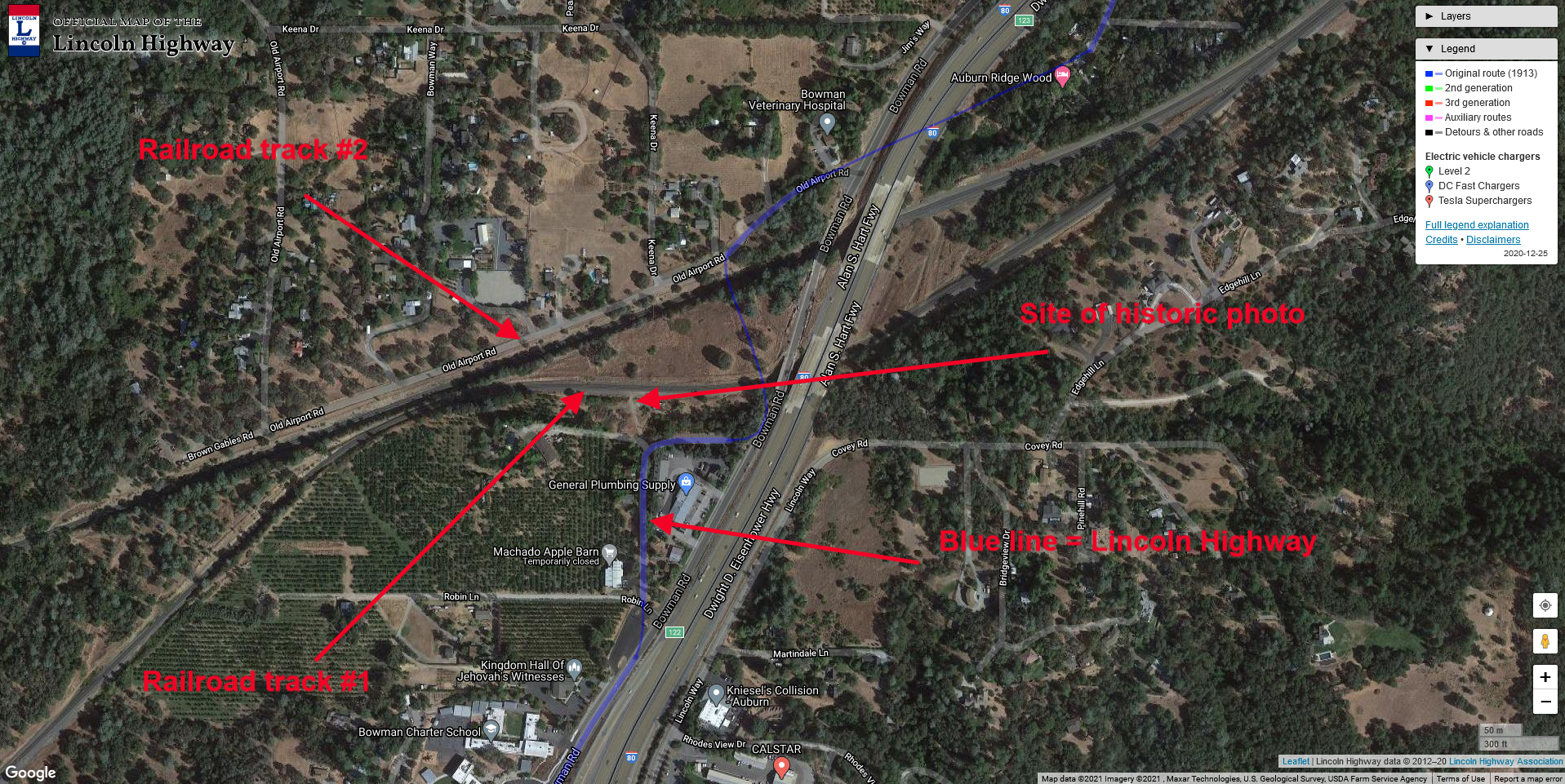
The map at right will show the general area and some of the features discussed. We can see the two rail lines, the Lincoln Highway's blue line, and the crossing pictured in the historic photograph. East is to the right, west to the left. Notice how the crossing in the historic photo is actually west of our Lincoln Highway map shows the crossing. Click map for a larger view.

The same spot as the historic photo, but today. You can see our truck at the left.
In the photo below, we have moved east and can now see the road's impression at right. It appears that once you crossed the first rail line, you would take a hard right and head east. You can see Monica in the background on the road. Our truck is on the other side of the tracks at the crossing.

While the impression we were following could be the road, it would be nice to find some more evidence that this was indeed the transcontinental highway's route. We found the evidence because of the recent clearing of trees and shrubs in this area. We found a state “C” monument facing east and another just a few yards away. These markers were placed along state routes from 1914 to the 1930s. Finding these markers is a great affirmation you are on the right track.

Here we see Monica by the “C” monument. The taller metal sign has the letters R/W on it, which means “right of way.” Placer County has put these metal markers at the site of these older stone monuments. This makes finding the old monuments much easier in this county than others who don’t mark these. We found another marker just a few yards from this one, giving us the road's general route. See the map below for more detail.

Covey Rd., which we originally had our route marked on, is actually a road that crosses over Highway 80. We do not believe the Lincoln Highway route crossed where we had originally marked it. Below we have marked where we believe the route actually crossed the first tracks and then made its way towards crossing the second set of tracks. There a long-gone bridge crossed the second set of rail tracks.
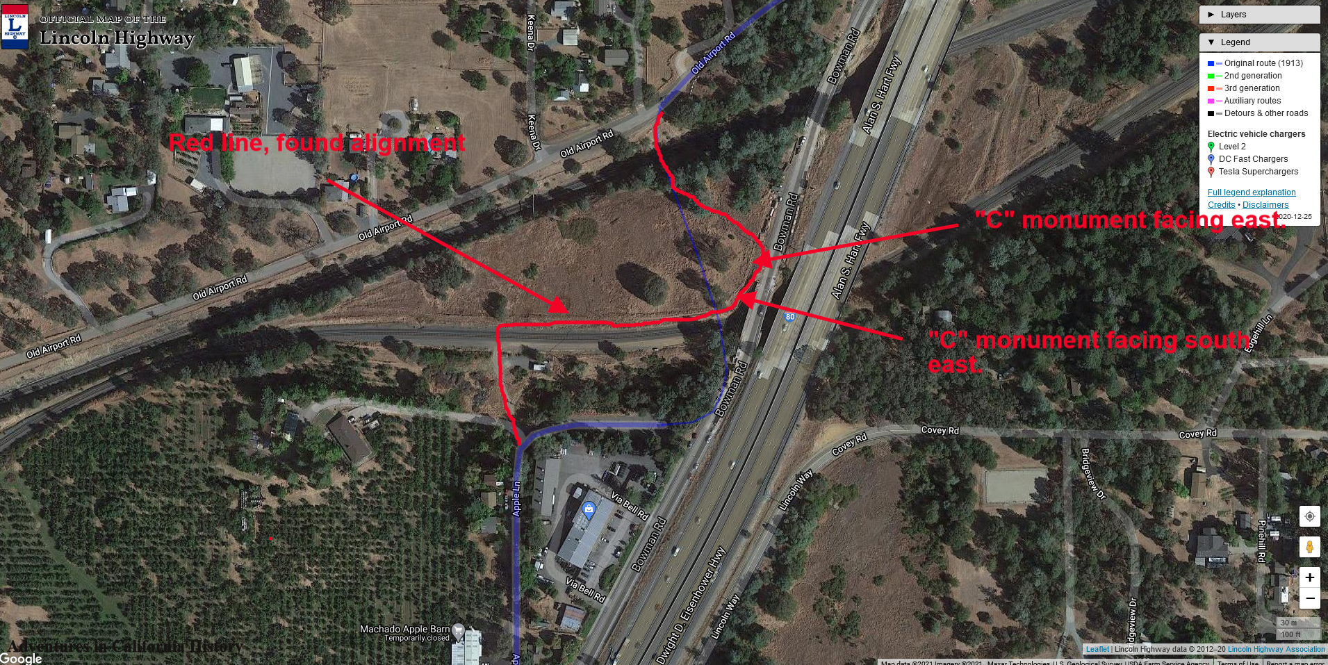
Click map for a larger view.
To summarize, the Lincoln Highway crossed the first set of tracks at a different place than we had earlier thought. After crossing the first set of tracks, the road makes an immediate right, following alongside the rail line, just before where the present Bowman Road is, a sharp left, then another left to head towards crossing the long-gone bridge over the second set of tracks.
These changes to the route are sent to the Lincoln Highway Associations’ cartographer. If they agree with our findings, we will change the official map to show the newly found route.
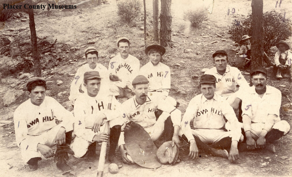
Iowa Hill Baseball Team in the late 1800’s. Two boys sit by the tree. Photo: Placer County Museums..
Iowa Hill William "Seattle Bill" James, baseball legend
We have discussed the above photo in a post that can be found here. It shows the Iowa Hill baseball team posing with a couple of children sitting by a tree. All the small mining towns in the foothills fielded baseball teams, and Iowa Hill produced a player that would eventually pitch in the 1914 World Series. William "Seattle Bill" James was the waterboy for the Iowa Hill team and can be seen sitting by the tree holding a watering can! Bill was born in 1892 and looked to be about five or six in the photo, which would make the date of the photo around 1897 or 98.

William “Seattle Bill” James pitching for the Boston Braves.
William Lawrence James was the third of four children of William and Emma James. Bill's father was a gold miner in Iowa Hill, and when Bill was 11, the family moved to Oroville, where his father took a job on a mining dredge. While his parents wanted a mining degree for their son, Bill had other plans. In the three years that Bill attended Oroville high, he matured into a 6'3", 195-pound pitching phenom. When Seattle of the Northwestern League offered him a contract before the 1912 season, he left school for good. More about Bill here at the Society for American Baseball Research.
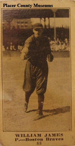
William James baseball card from 1916.
The above photo shows a baseball card with William pitching for the Boston Braves. Bill moved to the braves after playing for Seattle in 1912, where he was renowned for his fastball and spitball. William led the Seattle team to a pennant and helped guide the Braves to the championship. He was an early baseball superstar.
The photo below features James on a “cigar blanket”. I assume, because of the size of the “blanket”, that this actually sat inside a cigar box.
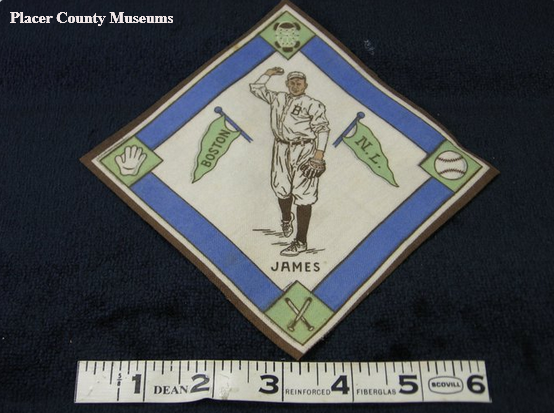
A “Cigar Blanket” featuring William James.
He attempted a comeback in 1918, but WWI called, so he served in the 63rd Infantry. There, his baseball arm came into use as he taught soldiers how to throw bombs. After the war, Bill played one major league game in 1919. From 1919 to 1925, he was a coach and player in the Pacific Coast League, from which he retired.
During retirement, Bill lived with his wife Harriet in Oroville. There he drove trucks and became an assessor for Butte County. He died on March 10, 1971, just shy of his 79th birthday., He is buried in Memorial Park Cemetery in Oroville.
William's story is fascinating as we can watch his development from a young waterboy in an isolated mountain town, Iowa Hill, to his fame as an early baseball player in the major league.
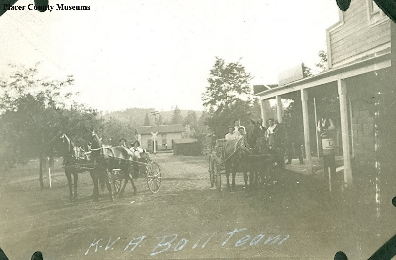
Horse and carriage were still popular well into the 20th Century. Note the Lincoln Highway “L” at right. Photo: Placer County Museums.
Alta and the Lincoln Highway
This photograph was taken in 1916 and showed the K.V.A. Ball Team in Alta, California. While we are not sure what the initials stand for, we are confident of the location. In the background, you can see a railroad crossing, which at this date would be the Southern Pacific Railroad. The building at right is the Alta Store, which still operates to this day.
Today’s Alta Bonny Nook Road was in 1916 the Lincoln Highway, which would have brought most transcontinental drivers right through the town. What’s fun about the above photo is a Lincoln Highway logo painted on a gas pump of some type. The Lincoln Highway Logo painted on telephone poles, bridges, and any other prominent spot was to help drivers navigate the country, and it would have been a central location in town. It was interesting to note no autos in the photo, but horses and buggies were still popular in the early 20th Century.
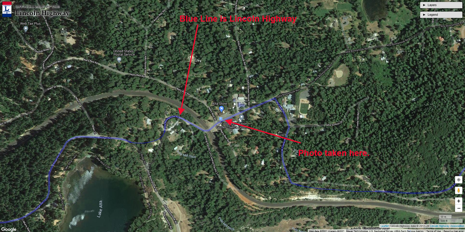
Map of location. Click photo for larger view.
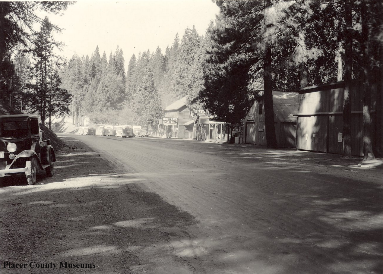
1936 photo showing about 6+ buses parked in front of Baxter’s Hotel. Photo: Placer County Museums.
A busy day at Baxter along old Highway 40
For many years, the mountain town of Baxter sat on the main transcontinental highway from Donner Summit to Auburn. Before the present Interstate 80 was built about 200 yards from this spot, everyone crossing the Sierra on Highway 40, the Lincoln Highway, stopped here to re-fuel and re-fresh. It's hard to imagine just how much traffic passed this way. These two photos help us to see the amount of traffic this small stop catered.
The above photo showed Baxter in 1936 when this was Highway 40. If you look closely down the road, there are at least 6+ buses parked in front of the Baxter's Hotel Lunch Counter. Figuring the buses were loaded with about 50 passengers, that means about 300 people are eating inside the building!
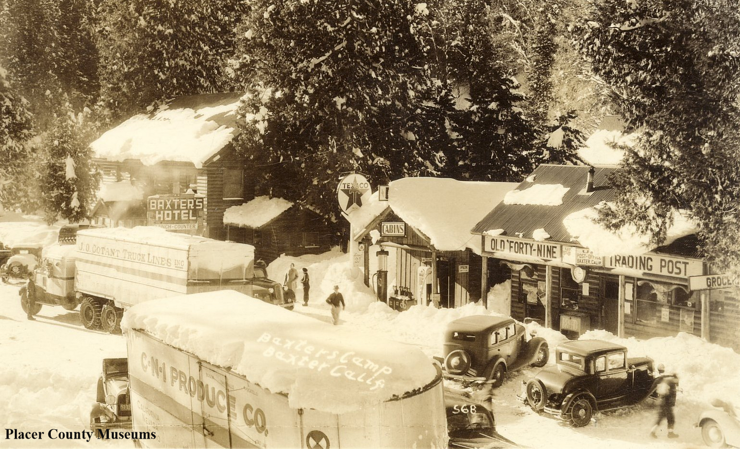
1926 photo showing trucks parked at Baxter, Placer County. Photo:Placer County Museums
Now let’s go back ten years to 1926 when this road was the Lincoln Highway. It appears that two big rigs have decided to stop for supplies after having crossed the summit and made it down the grade. There are plenty of automobiles parked around the front of the buildings, all visiting the Lunch Counter at the hotel or buying supplies at the “Old Forty-Nine Trading Post.”
The photo below shows Baxter today, looking east instead of west, like the older photos. The concrete foundation for the gas pumps can still be seen down the road by that building. Everything else has disappeared. The building standing in the photo seems to be a supply point for trucks harvesting water from Crystal Springs, nearby.

Baxter, looking east. Not much left of the old town.